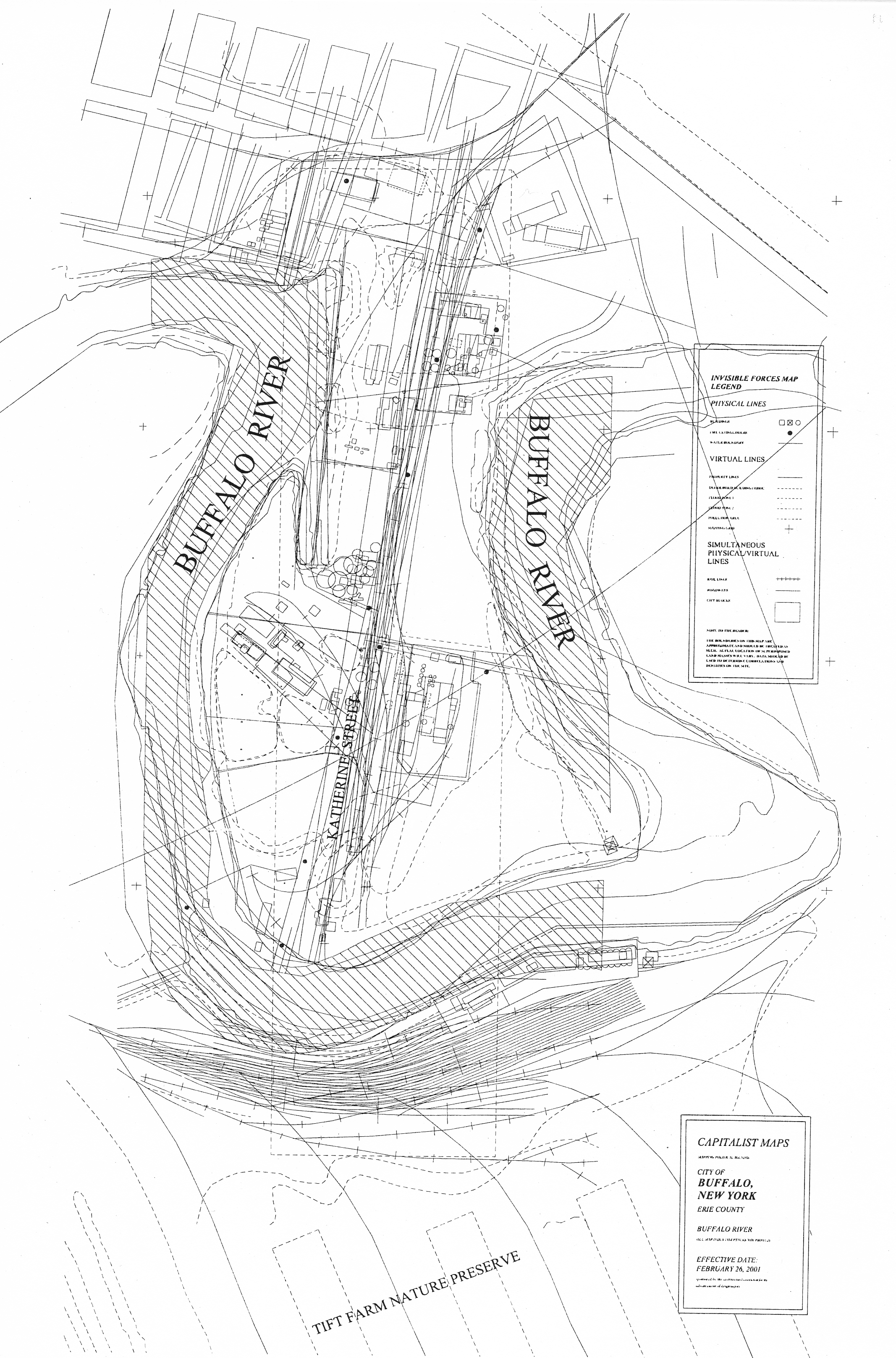
Charles Davis, “Capitalist Maps” (c.2001)
SURFACE EFFECTS
Professor: Shayne O’Neil, SUNY Buffalo (c.2001)
Studio Brief: The Surface Effects studio is neither an urban or a landscape investigation. It is about mapping, reprogramming, and activating derelict urban surfaces or topographies. The site is metropolitan in scale and regional in context. A nexus of infrastructural networks – the Buffalo River, the Buffalo Skyway, and the Central New York rail lines – delineate this surface. There are no guidelines for this studio, only a baseline: a set of enabling and diverse activities in time and a cartographic stratagem for tracing them.
The studio confronts the invisibility of ‘under-cover’ spaces by configuring hybrid programs and open design strategies for activating certain latencies within the urban field. The investigation of the Buffalo Rifer corridor begins by addressing the derivative condition that civic infrastructure (highways, railways, and waterworks more specifically) has inadvertently created a spent ecology of voids. With the increasing pressure for development of these unused spaces, the value of these void topographies will undoubtedly be recognized and will ultimately become integral parts of the urban and environmental diagram of the city of Buffalo. For the purposes of this studio, we shall consider the hitherto ‘invisible’ ground an open and available territory for urban reprogramming, landscape intervention, and social reoccupation.
PROCESS
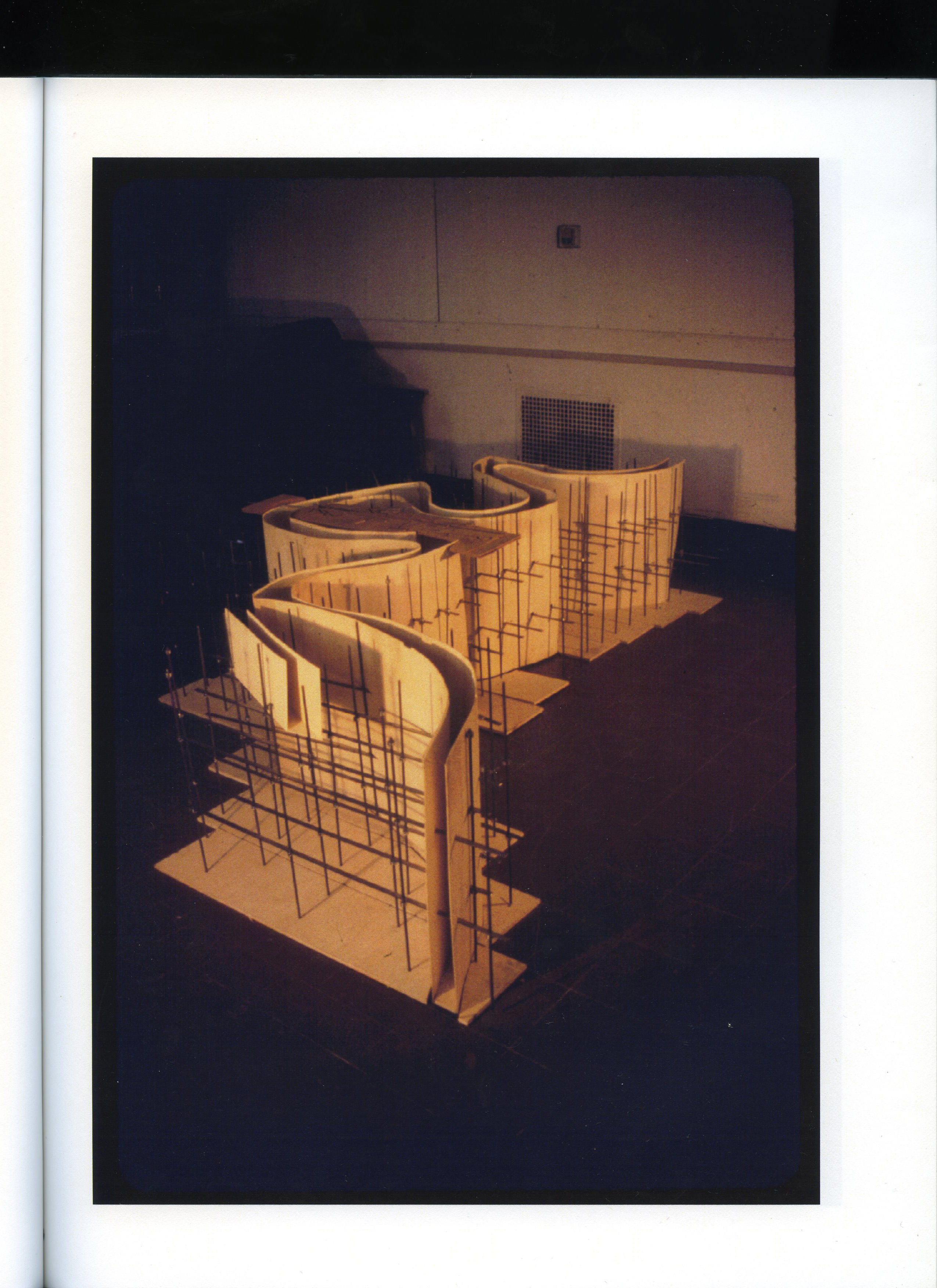
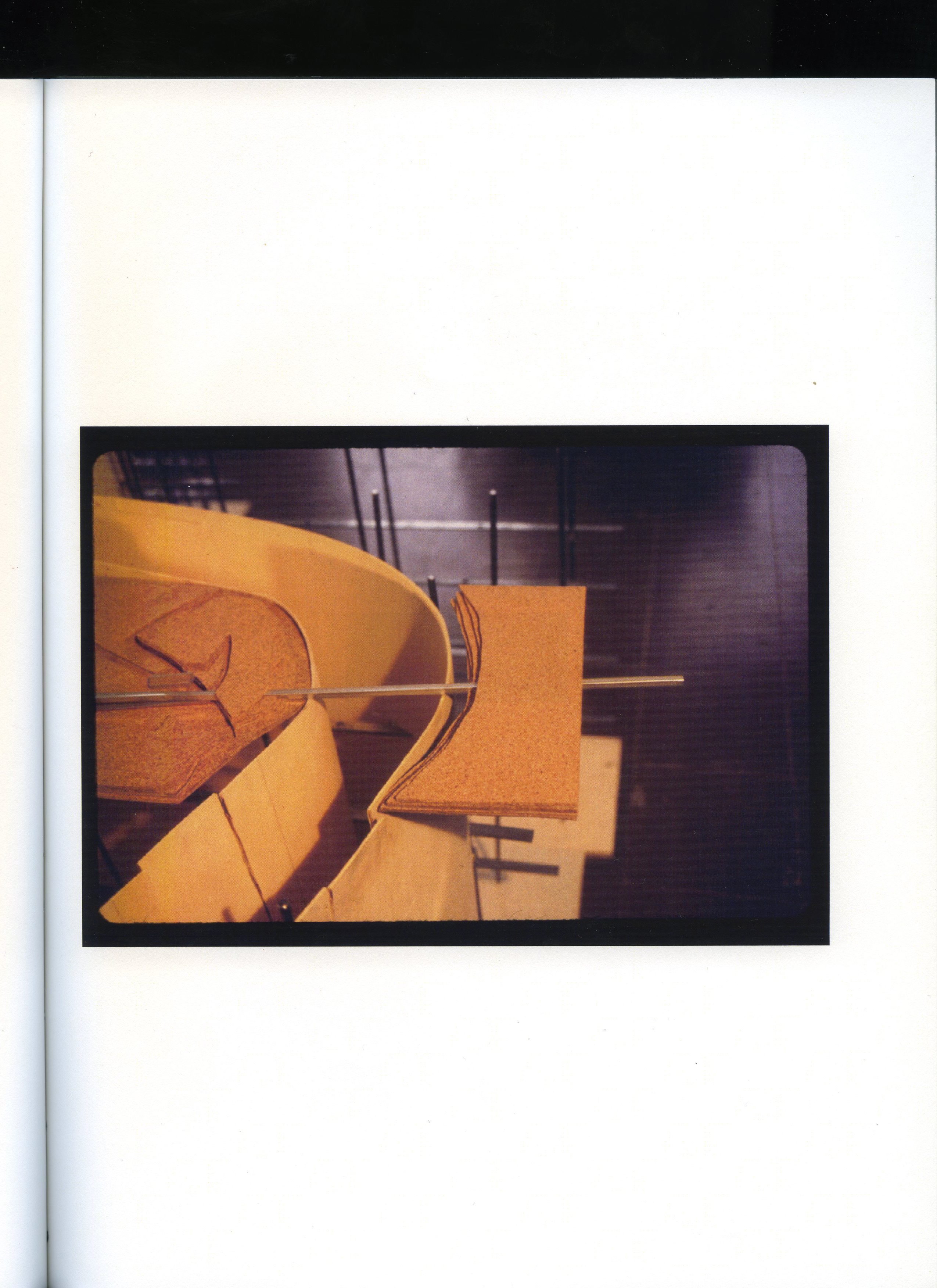
The purpose of this project was to reveal the invisible economic forces that structured the overall organization of the site. This ‘Marxist’ reading of the site enabled me to develop a formal strategy for challenging these forces. I began by collecting and tracing historical maps of this area of the Buffalo River (from 1810 onwards). I isolated the ‘capitalist’ markings within this data set, including the lot lines, the regularly placed fire hydrants, and the programmatic functions of each space. My final program was to create a new slip into the site by slowly ‘erasing’ the existing capitalist functions. This erasure would occur by purposefully increasing the rate of erosion and washing away a major area of the existing land mass. My mechanism for doing this was to begin at the water’s edge and drill large holes into the landscape. As these holes filled with water, they would erode the substructure of the site and slowly erode its foundations. As the existing land washed away, an invisible underwater bunker would slowly be revealed. This bunker contained a five mile long walkway with a museum of the economic exploitation (and eventual liberation) of the site.
While my final program for this site was not very practical, it allowed me to experiment with digital tracing techniques, analogue folding techniques, and develop a basic understanding of ecological forces along the river. I also think that the historical themes of my project foreshadowed subsequent interests in architectural history just a few years later.
ILLUSTRATIONS